Last additions - Dennis L Dauphin
|
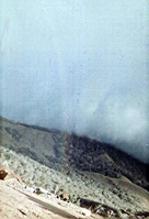
Rainbow.jpgRainbow at Highway 19Angular photo shows a rainbow passing directly over the Infantry company A-2-35 commanded by Capt Charlie Murray.
February, 1967.May 13, 2008
|
|
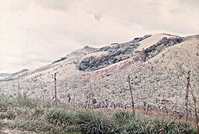
InsideARVN.jpgView from insidePhoto taken from inside the ARVN compound. Note the heavily fortified fence. February, 1967.May 13, 2008
|
|
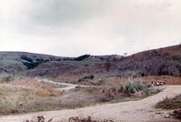
Hwy19-kids.jpgKids on the highwayDuring less dangerous times, Vietnamese kids hung around Highway 19.May 13, 2008
|
|
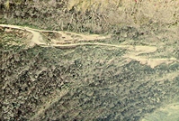
Hiway_19.jpgGoing Thru the PassThis is Highway 19 as it leads through the Mang Yang Pass.May 13, 2008
|
|
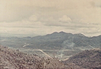
CommandingView.jpgHighway 19Hills protect either side of the Mang Yang Pass. In the center, Highway 19 leads to An Khe - Qui Nhon.
Picture taken from atop the Pass.May 13, 2008
|
|
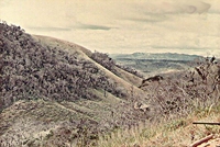
ARVN_perimeter.JPGCompound perimeterPhoto from inside the ARVN compound, looking outward from the perimeter. Notice gun barrel pointing out at lower right.May 13, 2008
|
|
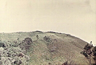
ARVN_Comp.JPGThe site of an important radio relay station manned by the ARVNs. It is directly in line with the ARVN compound on a higher peak.May 13, 2008
|
|
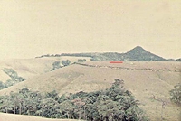
1stCav.jpg1st Cav was hereAt the right end of the red line is the famous 1st Cav Insignia. The 1st Cav held this Mang Yang Pass area for a long time prior to moving. The road leads to the mountain peak and stops.May 11, 2008
|
|
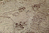
Tiger_Tracks.JPGTiger in the jungleA reminder that Vietnam was a jungle---fresh tiger tracks. These tracks were sighted by a patrol going up the Mang Yang peak. Highway 19, RVNMay 11, 2008
|
|
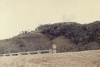
Hwy19_Bridge.JPGHwy 19 BridgeAnother view of the bridge from below. Note highway signs.May 11, 2008
|
|
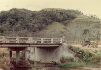
Hwy19-Bunker.jpgSide ViewSide view of tactical bridge site. The bunker at far right provided night protection. Snipers harassed our A/2/35 perimeter from the trees at top.May 11, 2008
|
|
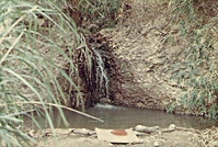
ColdShower.jpgUnder the BridgeThis rock waterfall leads to a stream which runs under the bridge on Hwy 19. This water provided and excellent shower point...but the water was very, very cold.May 11, 2008
|
|
| 191 files on 16 page(s) |
 |
 |
4 |  |
 |
 |
 |
 |
 |
 |
|
