Last additions - Danny Yates
|
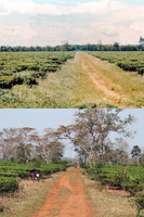
DY-37.JPGThen and NowThis is the tea plantation --it's still there, too--south of Pleiku along Hwy 19. About the only change is the trees have grown.Apr 15, 2012
|
|
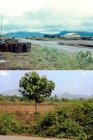
DY-32c.JPGThen & Now: the search for Base CampSo here is a then and now of our base camp.Apr 15, 2012
|
|
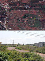
DY-32e.JPGThen & Now: the search for Base CampOur guide pointed out this road leading into our base camp area. Something about that looked awfully familiar. I've attached the picture along with a Google Earth screen print, marked with an "x" to show where the picture was taken. So close, and yet so far.
According to my letters home, base camp moved to an area south of Pleiku, probably Enari, in May of 1967.
Apr 15, 2012
|
|
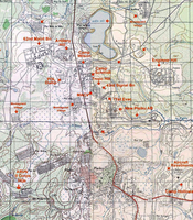
DY-32a.JPGThen & Now: the search for Base CampNext, I found this older map online showing the location of Engineer Hill.
That was pretty much where I expected it to be.
{See also: War Stories - Base Camp}Apr 15, 2012
|
|
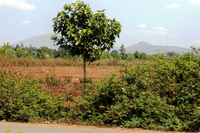
DY-32d.JPGThen & Now: the search for Base CampUnfortunately, when we got there, we found it was a restricted area (we couldn't even stop for pictures), so the attached picture is the best I could come with. Oh, how I would have liked to have been able to walk around that hill once more.Apr 15, 2012
|
|
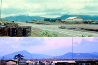
DY-32.JPGThen & Now: the search for Base CampOne of my goals on this trip was to find the location of the 2/9th base camp we had when I arrived in country in July, 1966. The first bit of evidence came when I found a picture online taken several years after we were there, and the person identified the picture as Engineer Hill. But I still didn't know where exactly that was.
{See also: War Stories - Base Camp}
Apr 15, 2012
|
|
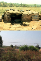
DY-31a.JPGThen and Now{First, go to Tab 1 and locate this bunker photo. It is in the 2nd row}
This is probably the least dramatic of my comparison pictures, but it means a lot to me because of the way I was able to find the location. The location is on Hwy 19, south of Dragon Mountain, near the Tea Plantation. Go to the map next.
Apr 13, 2012
|
|
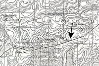
DY-31b.JPGThen and NowShortly before we left, my wife discovered an old map I
had ordered many years ago. On the map (see above) the
airstrip that was clearly marked next to the highway. That runway was just
across the road from my tent. Notice the notch in tea plantation below the airstrip.Apr 13, 2012
|
|
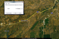
DY-31c.JPGThen and NowNext, I went on Google Earth to look at that location. In this screen print, you can find the same notch. I then used the mileage feature on Google Earth to measure the exact distance from that location back to the intersection where Hwy 19 and Hwy 14 split. I showed that picture to our driver so he could measure the distance on the odometer. Again, it's not a dramatic comparison, but the topography is the same. I
had a lot of fun just preparing for the trip.
Apr 13, 2012
|
|
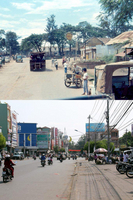
DY-30.jpgThen and NowHere is a comparison picture of downtown Pleiku. The Shell station in the old picture is now a Petrolimex station, as you can see in the second photo (see 30a).
Apr 10, 2012
|
|
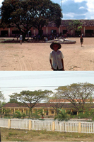
DY-29.jpgThen and NowI was able to find this school in Phu Cat. Hwy 1 runs through Phu Cat,
north of Qui Nhon, on the way up to Duc Pho, as you probably remember.Apr 10, 2012
|
|
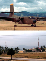
DY-28.jpgThen and NowHere is a comparison picture of the airstrip in Duc Pho. I wasn't able to make an exact comparison because I couldn't get to the other side of the runway, as it is a restricted area, but it is close enough to see how the area has changed. {However, the background is unmistakable!)
Apr 10, 2012
|
|
|
|
